Mullerthal Trail Route 2
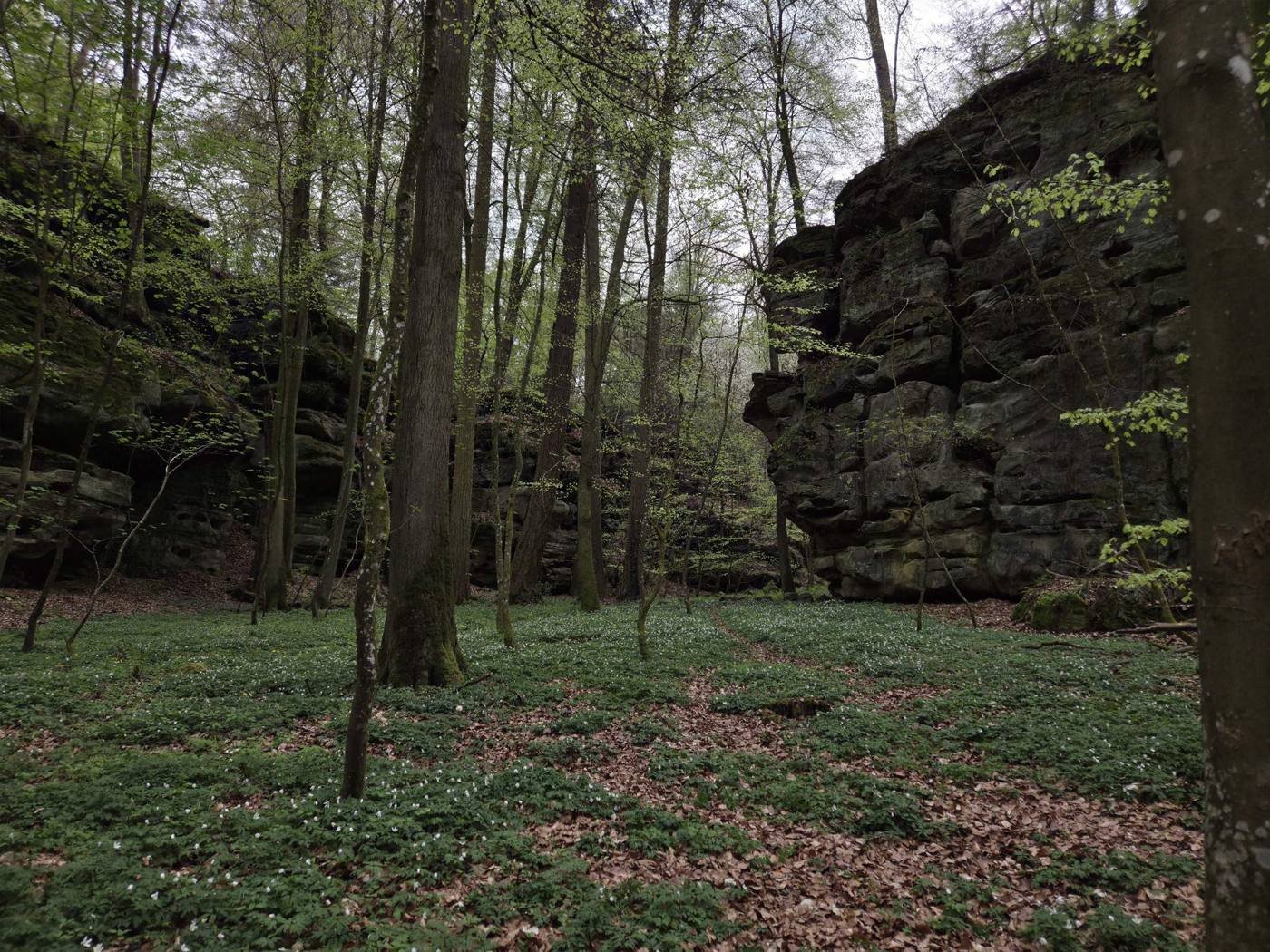
A 40 km loop from Echternach through the sandstone rocks, gorges and forests of the Mullerthal region, also called Luxembourg's Little Switzerland.
- Distance
- 39.7 km
- Walking time
- about 13 hours
- Stages
- 2
- Start and finish
- Echternach
Route 2 starts and ends at the basilica in Echternach. It climbs to the Trooskneppchen viewpoint above the town and goes through the Wollefsschlucht, a steep gorge in the rock, to the plateau around Berdorf. Near Berdorf you pass Perekop, a big rock you climb with ladders, and the Huel Lee cave, where millstones were once cut.
From Berdorf the trail goes down to Müllerthal and the Heringer Millen, and past the Schéissendëmpel waterfall with its small stone bridge. The second half passes the Eilebuerg, Goldfralee and Goldkaul rocks on the way to Consdorf and Scheidgen, and then back to Echternach.
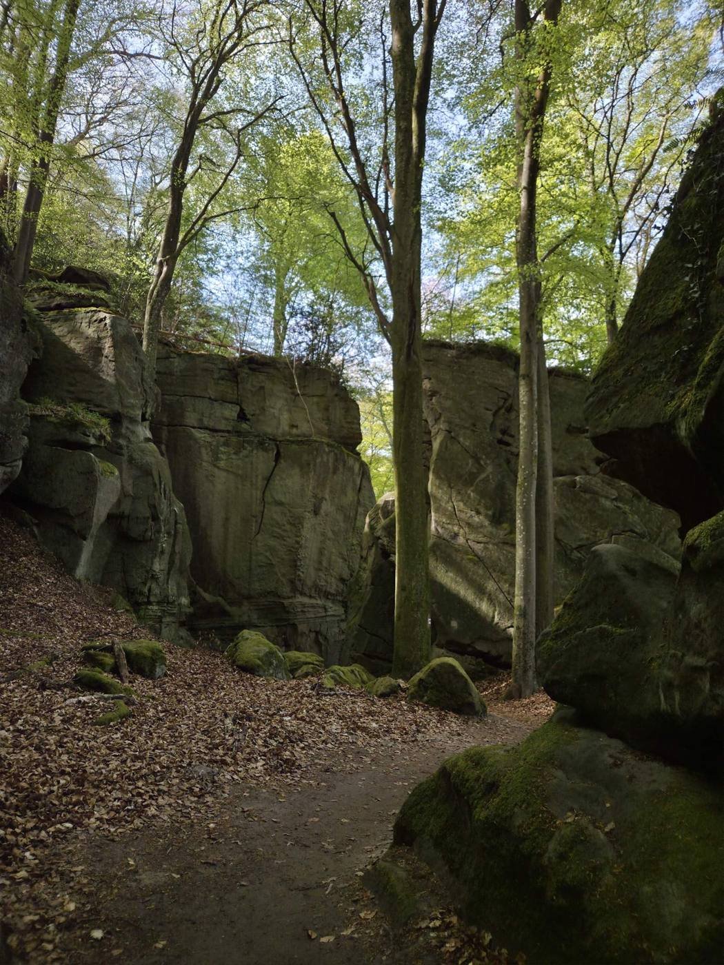
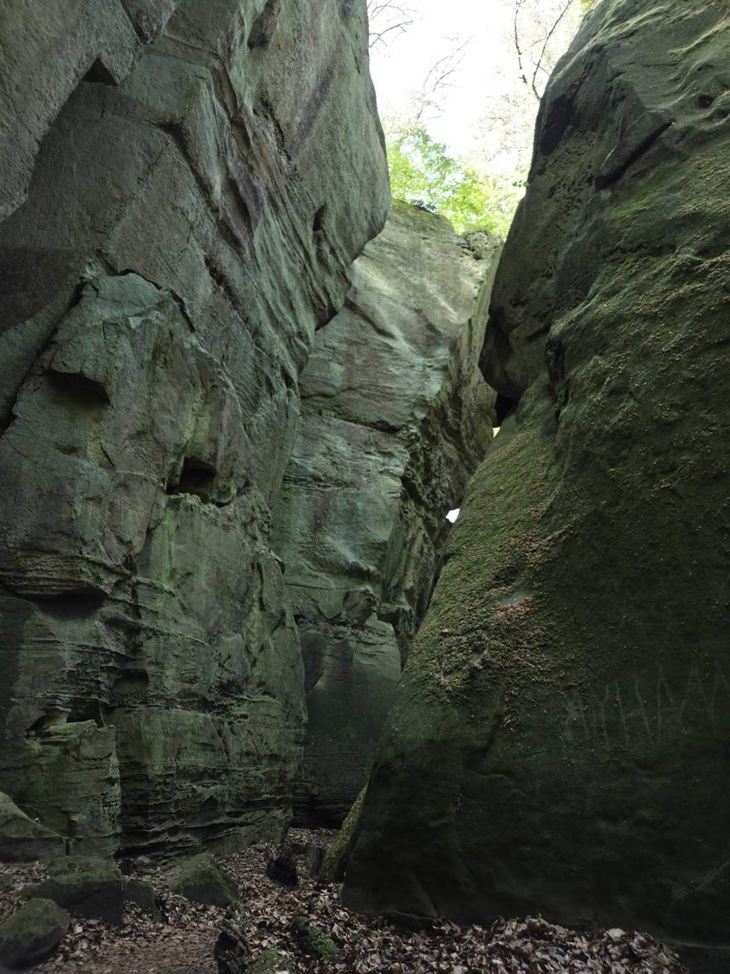
The Kuelscheier is a very narrow, pitch-dark passage between the rocks. The tourist office recommends a flashlight, and there is a detour if you don't want to squeeze through. You can also start the loop in Berdorf, Müllerthal, Consdorf or Scheidgen, and all of them have places to eat.
My trip
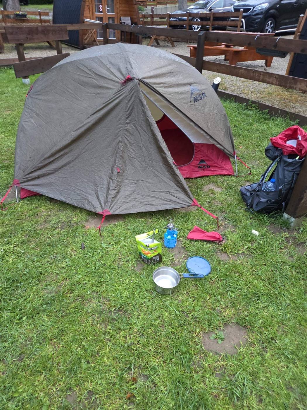
I hiked Route 2 in spring and camped at Camping La Pinède. Everything went into a 36-litre pack, with the tent strapped underneath.
What stood out to me was how narrow it gets between the cliffs. In places the trail runs through gaps in the rock that are only just wide enough to walk through.
You can see my recording of the hike on AllTrails.
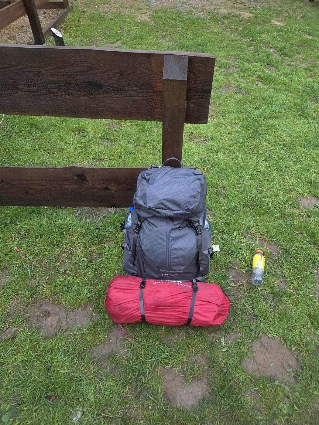
What I packed
| Osprey Stratos 3636 L backpack |
| MSR Elixir 2Two-person tent |
| Exped Versa 4RSleeping pad |
| Ayacucho sleeping bag |
| Gas canister stove |
| Pot with lid |
| Adventure Food freeze-dried meals |
| Meindl Vakuum GTXwornHiking boots |
| Decathlon hiking pants |
| Columbia fleeceBought second-hand on Vinted |
| HEMA gloves |
| Leki trekking polesworn |
Route facts come from the official Mullerthal Trail website. Check it for current information and detours before you go.